|
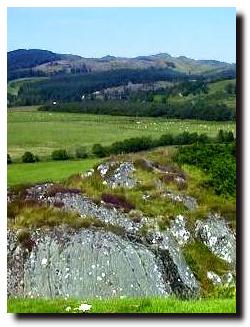
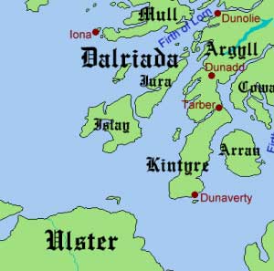
Dál Riata (also Dalriada or Dalriata) was a Gaelic kingdom on the western seaboard of Scotland with some territory on the northern coasts of Ireland. It was situated in what is now Argyll and Bute, Lochaber, and County Antrim.
Dál Riata is commonly viewed as having been an Irish Gaelic colony in
Scotland, although some archaeologists have recently argued against
this.[1] The inhabitants of Dál Riata are often referred to as Scots, from the Latin scotti for the inhabitants of Ireland, and later came to mean Gaelic-speakers, whether Scottish, Irish or other.[2] They are referred to here as Gaels, an unambiguous term, or as Dál Riatans.[3]
The kingdom reached its height under Áedán mac Gabráin (r. 574-608), but its expansion was checked at the Battle of Degsastan in 603 by Æthelfrith of Northumbria. Serious defeats in Ireland and Scotland in the time of Domnall Brecc (d. 642) ended Dál Riata's Golden Age, and the kingdom became a client of Northumbria, then subject to the Picts.
There is disagreement over the fate of the kingdom from the late eighth
century onwards. Some scholars have seen no revival of Dal Riata after
the long period of foreign domination (after 637 to around 750 or 760),
while others have seen a revival of Dal Riata under Áed Find (736-778), and later Kenneth MacAlpin
(Cináed mac Ailpín, who is claimed in some sources to have taken the
kingship there in c.840 following the disastrous defeat of the Pictish
army by the Danes): some even claim that the kingship of Fortriu was usurped by the Dál Riata several generations before MacAlpin (800-858).[4] The kingdom disappeared in the Viking Age.
more - 
|
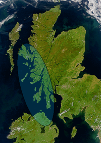
Satellite image of northern Britain and Ireland showing the approximate area of Dál Riata (shaded). The mountainous spine which separates the east and west coasts of Scotland can be seen.
|
|